Blog
Filter categoryImprove GIS print accuracy with map plotters

Technical Printing
|5 Jul 2023
Accurate printing of GIS (Geographic Information System) documents holds immense consequence for a wide range of professionals, ranging from topographers to cartographers and beyond. However, achieving optimal GIS print accuracy is an arduous task without the right map plotter printer. If you do not have the right printer for the job, plenty of inconsistencies, misalignments, and other issues can emerge during the printing process. Consequently, this can seriously impact the integrity of your GIS documents.
This is where map plotter printers come in. By leveraging the advanced printing technologies and specialized features of a map plotter printer, professionals will find an invaluable solution to their non-negotiable requirement of GIS print accuracy in their output. Moreover, by understanding how a map plotter printer can significantly improve the quality and precision printing of GIS documents, professionals can elevate their GIS print accuracy to new heights.
The Importance of GIS
Overview of GIS (Geographic Information System)
Importance of Accurate Printouts for GIS
Map Plotter Printers and Enhancing Map Accuracy
Understanding GIS Print Accuracy
The Importance of Print Accuracy in GIS Documents
Printing Factors With the Greatest Impact on GIS Print Accuracy
Common Challenges Faced in Achieving Accurate GIS Prints
GIS professionals often face challenges in matching their data to the right printer and printing settings to achieve the most accurate GIS documents. These are the most common difficulties in achieving highly accurate printing solutions.
1. Discrepancies Between Data and Output Formats
2. Inaccuracies in Data
3. Alignment and Registration Problems
4. Colour and Symbol Reproduction Inconsistencies
5. Printer Limitations
6. Dealing with Large Datasets or Complex Maps
7. Data Loss or Compression During File Transfer or Conversion
8. Maintaining Consistency
9. Integrating Different Data Sources Into a Cohesive Map
10. User Errors in Configuring Print Settings or Interpreting GIS Software Outputs
The Role of Map Plotter Printers in Achieving GIS Print Accuracy

What Are Map Plotter Printers?
What Are the Key Features of Map Plotter Printers for GIS?
How Map Plotter Printers Can Enhance GIS Print Accuracy and Overcome the Challenges of Application
**1. Map Plotter Printers Have High-Resolution Capabilities **
**2. Map Plotters Utilize Advanced Printing Technologies **
3. Map Plotter Printers Employ Precise Calibration and Alignment Techniques
4. Colour and Symbol Reproduction
5. Printer Capabilities
6. Ability to Handle and Process Data
7. Ability to Transfer and Convert Data
8. Consistency and Standardization Are Guaranteed
9. Integration of Data Sources
10. User-Friendly Interface
Best Practices for GIS Printing With Map Plotter Printers
Prepare Your GIS Data and Maps for Printing
Ensure You Properly Handle and Maintain Your Map Plotter Printer
Take Quality Control Measures to Ensure Accurate Prints
Archive and Organize Printed Maps for Future Reference
Keep note of how previously printed maps were created and the settings that worked best for you. This will help you achieve similar accuracy and satisfaction with future prints.
Reach Out to HP to Receive GIS Map Printing Solutions
GIS map printing is a highly specific use for plotter printers that HP is proud to assist with. If you would like to discover printing solutions or work with our printing experts to find the best settings and configurations to achieve your desired accuracy of GIS prints, then HP is here to help. Contact us for map plotter printer support at any time.
Download our eBook now and discover how innovation is streamlining workflows, producing prints of unmatched quality and increasing IT efficiency like never before.
Download eBook nowExplore plotter printers for your needs
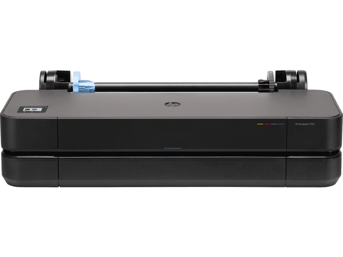
HP DesignJet T250 24-inch Compact Large Format A1 Plotter Printer + HP DesignJet T200/T600 Automatic Sheet Feeder + HP Installation Service for Design
A1 Colour HP DesignJet Large Format Printer, Perfect for Small Offices & Business Print 30 sec/page on A1; 76 A1 prints per hour USB, Ethernet, Wi-Fi Touchscreen; Automatic document feeder; Front USB flash drive port
MYR 5860.00MYR 4980.00Buy Now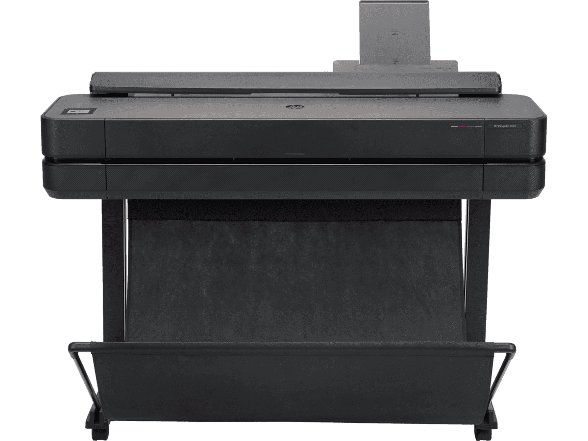
HP DesignJet T650 36-in Printer + HP Installation Service for DesignJet Series Entry Level (APJ)
A0 Colour HP DesignJet Large Format Printer, Perfect for Small Offices, Business & Enterprise Print Sheet feed, Roll feed, Automatic Sheet Feeder, Media Bin, Automatic Horizontal Cutter USB, Ethernet, Wi-Fi HP Click, HP Smartapp
MYR 11640.00MYR 9880.00Buy Now


