Blog
Filter categoryGIS mapping tools for civil engineering printouts

Technical Printing
|5 Sep 2025
Maps have a critical functionality that goes beyond visual representation in civil engineering. Instead, they serve as essential planning tools to assist with site selection, infrastructure layout, and environmental assessment, among other aspects of the engineering process. One solution that can help with this is a Geographic Information System (GIS) mapping tool, which architects and engineers can use to develop comprehensible layered visuals of spatial data. By using GIS for civil engineering print projects, multiple teams on a project can get a complete picture of a facility's zoning, terrain, utilities, and other elements.
To get the most from GIS for civil engineering, it's important to use reliable large format printing equipment that's compatible with your GIS mapping tools. The right printers can generate high-quality maps that facilitate effective collaboration throughout civil engineering projects. This article will explore:
- GIS software architecture
- How to prepare GIS maps for printing
- Some issues to avoid when printing
- Guidance on selecting the ideal printer to produce the best results
The Role of GIS in Civil Engineering Projects
GIS mapping tools are critical for civil engineering. They enhance both planning and design, as well as engineering workflows. The following is a deeper look into the benefits of implementing reliable GIS software architecture for various projects.
How GIS Data Supports Planning and Design
There are several ways GIS for civil engineering assists with the planning and design process, including:
- Optimised Site Analysis: One of the main advantages of good GIS software architecture is the ability to effectively assess project sites. It uses layered data, including soil composition, topography, and existing infrastructure.
- Enhanced Site Planning: Spatial analysis and visualised data layers can help engineers optimise plans and designs for greater efficiency. For example, they can ensure that structural designs integrate seamlessly with the surrounding landscape.
- Facilitating Collaboration: Effectively convey complex project details in a format that multiple parties can understand. This helps with communication at every phase, all the way through to completion.
Common GIS Outputs in Engineering Workflows
GIS for civil engineering can also provide multiple outputs to streamline workflows, such as:
- Maps and visualisations
- Reports and dashboards
- Spatial analysis and detailed models
- Data layers and sets
- Scenario simulations
Turning GIS Data Into Print-Ready Maps
While reliable GIS software architecture can assist with planning and design processes, you need to effectively prepare the data to produce high-quality prints using large format printers.
Preparing Layers and Legend Information for Output
You will first need to prepare all layers and the legends for output to printers. You can do so by prioritising layers based on the objective of the map; make sure all required layers are visible. Also, clearly label all legends, and use easy-to-understand symbols in a prominent location.
File Formats and Software Compatibility Tips
You must also select the correct output file format. The most common format is Shapefile (.shp), as it works with most GIS mapping tools. But you may opt for others, depending on the application. Other options for GIS in civil engineering include GeoJSON (.json) for web-based GIS mapping and Geodatabase (.gdb) for the ArcGIS platform.
Managing Resolution and Scaling Issues
Be sure to choose the right resolution when preparing GIS for civil engineering prints. For example, choose the right dots per inch (DPI) for your prints. The ideal resolution for more detailed prints is around 300 for detailed colour prints and 150 DPI for black-and-white visuals.
Additionally, the scale of the visuals within the GIS mapping tools should reflect the print scale.
Benefits of Large Format Printing for GIS Maps

There are multiple advantages of large format printing of GIS for civil engineering, including:
Enhanced Clarity for Multi-Layered Maps
When developing complex visuals with several layers, large format prints can incorporate all of a map's details into a single, comprehensible format that you can share across teams.
Suitable Print Sizes for Field and Office Use
Whether you want to provide prints for field employees, executives, or others, you can translate digital designs into high-quality prints on various materials for use in any environment.
Accurate Colour Reproduction and Labelling
Using the right print software and equipment, you can accurately match digital designs' colours and include all labels as they're intended to appear. One key aspect is to make sure you choose the Cyan, Magenta, Yellow, Key/Black (CMYK) colour space for physical prints.
HP DesignJet Solutions for GIS Applications
When you're searching for the perfect solution to print GIS for civil engineering, consider using HP DesignJet technical plotters for the following key reasons:
Print Precision and DPI Requirements for Map Output
HP DesignJet printers offer superior precision for GIS mapping to maximise accuracy and show every little detail, including all colours and legends with high DPI. You can also choose from many print sizes based on the size of the prints required for your projects.
Seamless Integration With GIS and CAD Tools
Another advantage of using HP DesignJet is the ability to effectively integrate these printers with your existing GIS mapping tools. They are compatible with QGIS, ArcGIS, and others, along with some of the most popular CAD tools like AutoCAD and other Autodesk solutions. As such, you can easily incorporate our large format printers into your workflows.
Durable Prints for Outdoor and Presentation Use
Choose from many graphics print materials for different types of applications, whether you need films for in-field use or bond and coated papers for presentations. At HP, you can find the perfect solutions for GIS for civil engineering.
Deliver Clear, Impactful GIS Maps With HP DesignJet
Want to reap the benefits of GIS for civil engineering? You'll be able to get the best results from your project in every way with the help of HP DesignJet printers. Regardless of your project requirements, you'll find the right printer for the job, along with high-quality inks, toners, and print media.
HP DesignJet printers also feature user-friendly designs, with accessible interfaces for easy programming and compatibility with most types of GIS mapping tools and CAD software. Various printer sizes are also available, whether you're seeking a more compact model to save space or a larger printer that can produce some of the biggest prints for presentation.
Get started on finding the perfect printer with our DesignJet promos.
Explore plotter printers for your needs
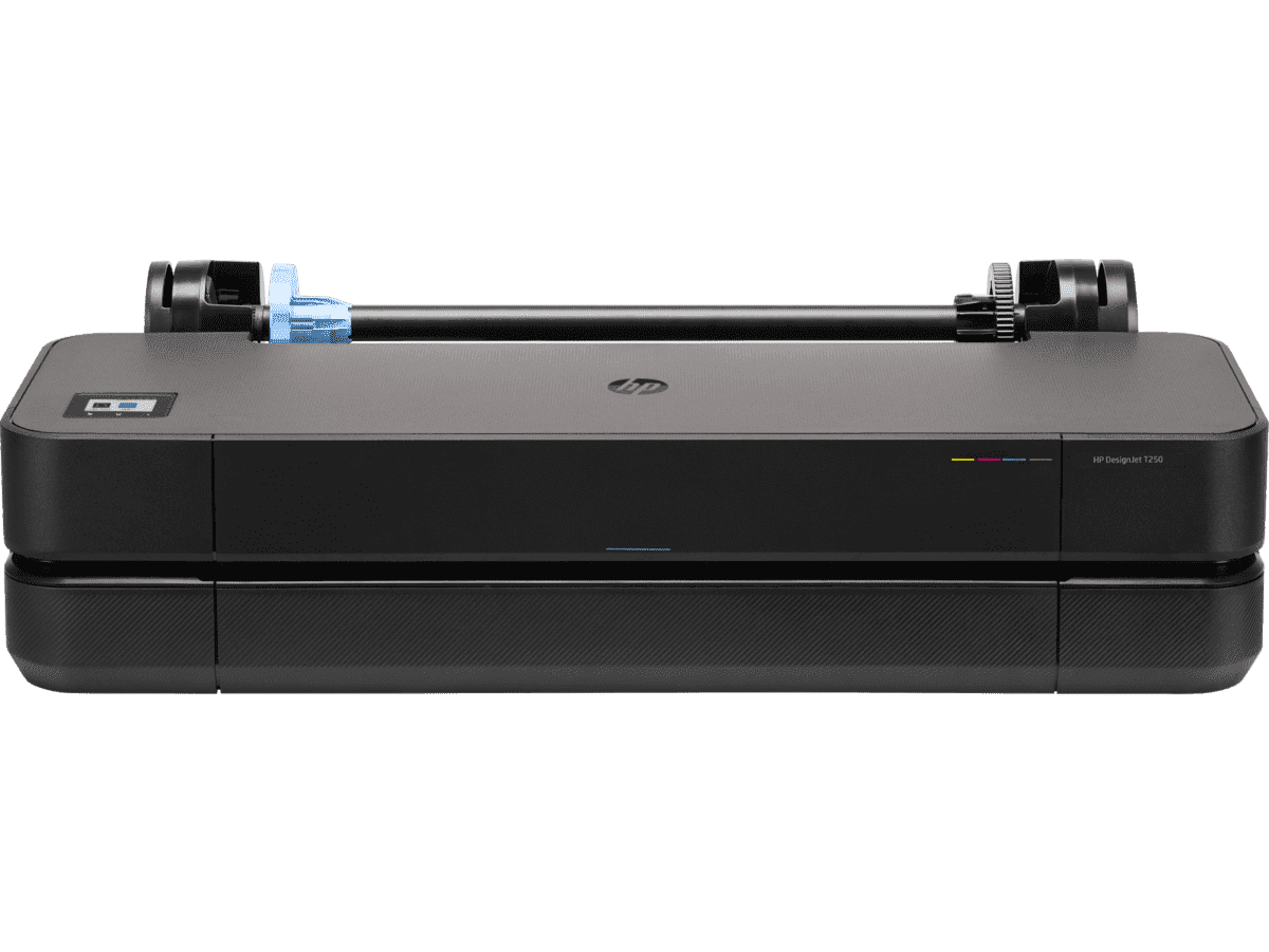
HP DesignJet T250 24-inch Compact Large Format A1 Plotter Printer + HP DesignJet T200/T600 Automatic Sheet Feeder + HP Installation Service for Design
A1 Colour HP DesignJet Large Format Printer, Perfect for Small Offices & Business Print 30 sec/page on A1; 76 A1 prints per hour USB, Ethernet, Wi-Fi Touchscreen; Automatic document feeder; Front USB flash drive port
MYR 5860.00MYR 4980.00Buy Now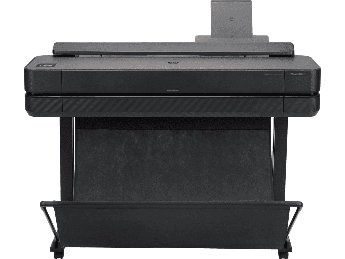
HP DesignJet T650 36-in Printer + HP Installation Service for DesignJet Series Entry Level (APJ)
A0 Colour HP DesignJet Large Format Printer, Perfect for Small Offices, Business & Enterprise Print Sheet feed, Roll feed, Automatic Sheet Feeder, Media Bin, Automatic Horizontal Cutter USB, Ethernet, Wi-Fi HP Click, HP Smartapp
MYR 11640.00MYR 9880.00Buy Now


