Blog
Filter categoryConvert GIS Data into Print-Ready Large Maps

Technical Printing
|20 jul 2023
Converting GIS data into high-quality large-format prints is critical in effectively communicating spatial information. Whether it's creating maps, posters, or visualisations, accurate and vividly aesthetic representations of GIS data are essential. They facilitate meaningful discussions about geospatial observations and patterns in the GIS and topographic industry.
This article will explore the entire process of transforming GIS data into detailed large-format prints. These documents can empower GIS professionals and topographers to use their GIS data for meaningful analysis. From preparing the data to selecting the right printer and optimising print settings, a comprehensive breakdown of each important step in the conversion process will be discussed in detail.
Why Convert GIS Data Into High-Quality Large-Format Prints?
Geographic information systems (GIS) produce data that experts use in the real world—often for large-scale projects like land development, architecture, and city planning. High-quality and large-scale prints are essential to many workflows. So being able to create them with large-scale printing is a must.
The Link Between Quality GIS Data Output, Communication, and Decision-Making
Understanding GIS Data Conversion
GIS documents are created by combining hundreds to thousands of data points layered into a single document. However, printers require image file types. Therefore, data conversion in GIS becomes an essential part of the process.
Converting GIS Data Into Printable Formats
Common File Formats Used in GIS Compatibility With Large Format Printers
GIS Software and Tools in Preparing Data for Print
Preparing GIS Data for Print

What to Consider When Preparing GIS Data for Large Format Prints
Data Cleanup
Projection Adjustments
Scale Adjustments
Data Simplification and Generalisation for Improved Print Quality
Selecting the Right Large Format Printer
The right printer is essential for large-format printing of GIS data. The printer must be able to hold the full size and detail of the document and print with extreme accuracy to provide the best quality print.
Large Format Printers Suitable for GIS Data Prints
Printer Specifications and Capabilities Required
Selecting a Printer That Can Handle GIS Data
Optimising Print Settings on a Large Format Printer
Print Settings That Produce Optimal GIS Data Printouts
The Best Print Mode, Paper Type, and Ink Settings for GIS Data Output
Quality Control and Proofing Prior to Printing Large Format GIS Data
Top Methods for Quality Control Prior to Large Format Printing
Ensuring Data Accuracy, Visual Clarity, and Overall Print Quality
The Importance of Test Prints and Proofing
Post-Printing Considerations About GIS Data Prints
How to Maintain GIS Data Prints' Durability and Longevity
How to Protect and Best Showcase Your Large Format Prints
Lamination
Mounting
Framing
Troubleshooting Issues When Converting GIS Data into Large Format Prints
Common Issues Converting GIS Data Into Print Output
Colour Inconsistencies
Artifacts
Printing Errors
Solutions and Tips to Achieve the Desired Print Quality
Reach Out to HP to Receive GIS Map Printing Solutions
HP printer experts will be happy to help you find the best high-quality plotter printer to create your large-scale GIS maps and documents. Contact us to discuss your printing needs or seek support on your current HP printer, and we'll help you achieve the best possible print quality.
Download our eBook now and discover how innovation is streamlining workflows, producing prints of unmatched quality and increasing IT efficiency like never before.
Download eBook nowExplore plotter printers for your needs
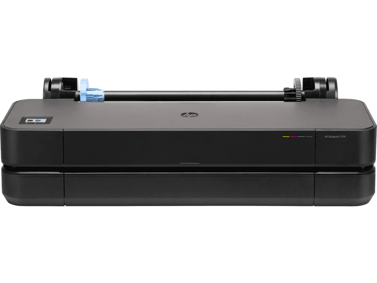
HP DesignJet T250 24-inch Compact Large Format A1 Plotter Printer + HP DesignJet T200/T600 Automatic Sheet Feeder + HP Installation Service for Design
A1 Colour HP DesignJet Large Format Printer, Perfect for Small Offices & Business Print 30 sec/page on A1; 76 A1 prints per hour USB, Ethernet, Wi-Fi Touchscreen; Automatic document feeder; Front USB flash drive port
MYR 5860.00MYR 4980.00Buy Now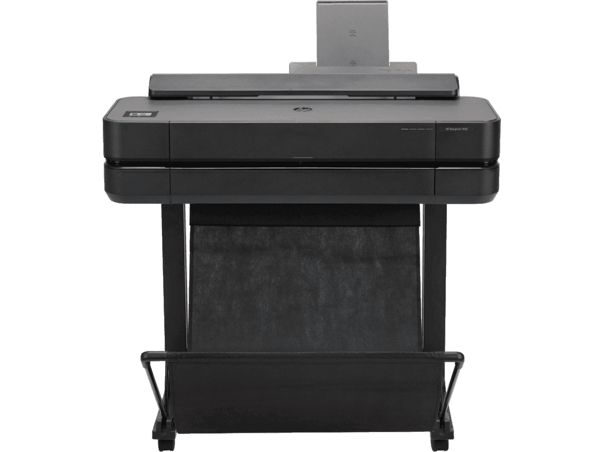
HP DesignJet T650 24-in Printer + HP Installation Service for DesignJet Series Entry Level (APJ)
Functions: PrintAuto sheet feeder: A4, A3; manual feed: A4, A3, A2, A1Print quality color: Up to 2400 x 1200 optimized dpiPrint speed: 26 sec/page on A1, 81 A1 prints per hour[1]Number of print cartridges: 4 (C, M, Y, K)
MYR 8570.00MYR 6880.00Buy Now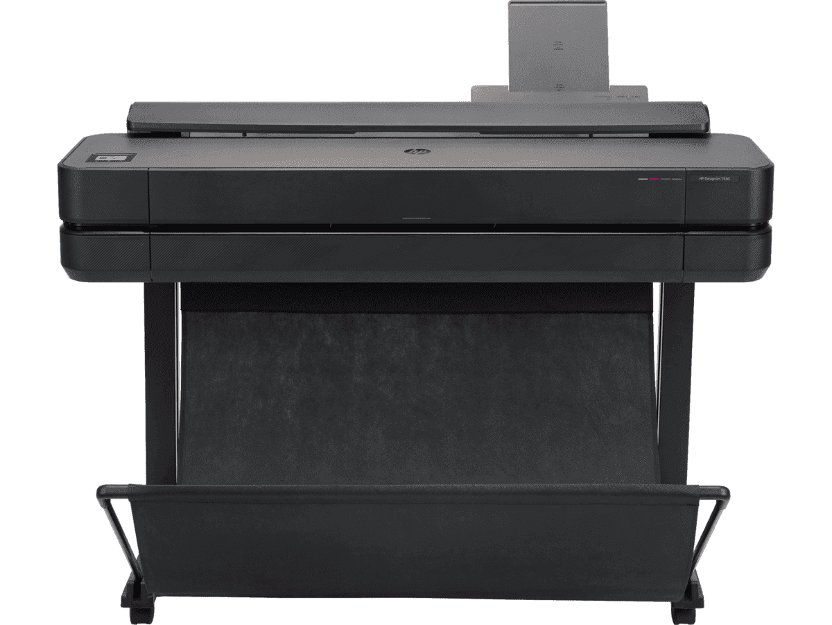
HP DesignJet T650 36-in Printer + HP Installation Service for DesignJet Series Entry Level (APJ)
Functions: PrintAuto sheet feeder: A4, A3; manual feed: A4, A3, A2, A1, A0Print quality color: Up to 2400 x 1200 optimized dpiPrint speed: 25 sec/page on A1, 82 A1 prints per hour[1]Number of print cartridges: 4 (C, M, Y, K)
MYR 11640.00MYR 9880.00Buy Now


